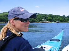
The following account is the story of my training, the tidal planning and ultimately the attempt itself.
The plan was hatched in the middle of winter. It was cold and frosty, snow was forecast, so I got my boat out. I don't really believe in the idea of a paddling season. I just put more clothes on when it's cold and get on with it.
Anglesey has everything in the tidal planning textbook. There are conventional 6 hours each way tides, there are floods stronger than ebbs, ebbs stronger than floods, inshore flow that starts before offshore flow, offshore flow stronger than inshore flow, tide races on many of the headlands, eddies behind headlands and then there is the Menai Straight where all rules are broken. A circumnavigation attempt can fail at the planning stage so I spent many happy hours poring over books, charts and maps, safe in the comfort of my living room.
The first decision was which direction to go in. That was the easy bit. The flood on the west and north coast is stronger than the ebb, while the ebb is stronger in the Menai Straight. Clockwise has to be the faster option.
The next dilemma to work out is the starting point. First I identified the crux section, which I took to be the transition from flood to ebb at the entrance to the Menai Straight. If this bit goes wrong I end up paddling uphill, just when I'm 3/4 of the way round and absolutely shattered. I'm also keen to be in the Straight, where the shore is never far away towards the end of the attempt.
I'm keen to do as little paddling in the dark as possible. Spring floods tend to begin in the small hours of the morning leading to a pre-dawn start on the west coast. The area between Llanddwyn Island and Rhoscolyn has very little flow close inshore, so starting here in the last few hours of ebb could be a good plan, getting me to Rhoscolyn, just as the flood is beginning. This way I can make full use of the flood round Penrhyn Mawr and the Skerries and as far as possible towards Puffin Island.
My sources of tidal information included the tidal stream atlas in Ralph Morris' 'Cruising Anglesey and Adjoining Waters', Terry Storry's 'Snowdonia, White Water, Sea and Surf' and the diamonds on the Admiralty charts. Terry Storry's book (sadly out of print and hard to come by)had the most detailed information regarding tidal streams close inshore. I had also done some home research on many previous trips to Anglesey.
Finally I drew all over a map of Anglesey, a black line for my estimated paddling speed of 7km/hr and a red line for the expected tidal assistance for each hour of the journey. This method gave me an estimated time of fourteen hours for the whole trip. It certainly looked feasible.
As far as training goes, I didn't do anything special in preparation for this attempt, just went out paddling as often as possible. I tend to focus on technique more than fitness and so every trip I am constantly working on efficient forward paddling. I use a wing paddle which I think makes it easier to generate a good efficient style, in that the paddle does a lot of the work for you.
There is no such thing as a low angle stroke with wings!
Planning dictated a 5am start and I was already beginning to regret the whole idea as the alarm reverberated around my trusty paddle waggon, in which I had been sleeping. It was the middle of the night. Reluctantly I got up, dressed and breakfasted and got ready to face the challenge.

Pitch black, and I'm going paddling, alone, how daft can that be? I certainly felt a little daft as I set out for Rhoscolyn Beacon without a clue as to where Rhoscolyn was. Eventually I made out the lights of the nearby village, so set off for a point just to the left of the most westerly light. What little night vision I had was instantly spoiled every time I looked up. The floodlights at Valley Airfield are certainly bright.
Just as I began to feel the helpful pull of the tide, someone switched the lights on and dawn had dawned. Rhoscolyn beacon was right in front of me and I was already ahead of my schedule. No stopping, straight to Penrhyn Mawr with the tide accelerating all the time. The tide race was running with waves over my head and one that helpfully broke over me sending gallons of water straight down the open neck of my cag. Great, I had no plans to stop en-route so was destined to spend the rest of the day in wet fleece, lovely. My paddling speed briefly reached 15km/hr then plummeted as I ploughed through an eddy. It took nearly a kilometre to get back to a decent speed. I was keen to avoid these eddies as I needed all the help I could get to get the journey completed. In comparison, South Stack was flat, fast moving but flat. I shot past the lighthouse and on past north Stack, staying well out into the current. In the haze of early morning I couldn't make out the Skerries or Carmel Head so I just set off for where I thought they should be and hoped that I wouldn't get it wildly wrong. Just as Carmel Head was making its presence known, I saw the Langdon Bank buoy, and shortly after, crossed an area of decidedly funny water. This was fun. By now I was well into my stride and initial aches and pains had gone, the sun was burning through the mist and I spent a wobbly minute or two delving into my day hatch to exchange woolly hat for sunglasses.
The north coast seemed to fly by. Tidal assistance was great and progress was marked by a quick succession of mice, approximately forty minutes from West to Middle Mouse and a further forty from Middle to East Mouse. At Point Lynas, I thought I was paddling well offshore in order to keep out of the eddy that forms behind the point. The GPS track shows that I was nowhere near as far out as I had planned. Still, I think I avoided the eddy.

The section from Point Lynas to Puffin Island was hard. It took me two and a half hours to cover the twenty kilometres and it was unremittingly boring. I was half way across before I could even see Puffin, so most of this section was paddled on a bearing. With no coastline close by to change the view I had to resort to crazy tactics to maintain some form of mental stimulation. First of all I tried counting paddle strokes. That was about as exciting as watching paint dry. Then I measured how far I moved in 100 strokes and calculated how many strokes to Puffin Island. The result, 4000 was depressing. Then I tried guessing when I had covered a kilometre. To start with I was fairly accurate but as I got more tired my guesstimates got shorter and shorter. For a while I used my tried and tested technique of self-coaching my forward paddling style; ten minutes of concentrating on my feet, ten minutes getting the catch further forward, looser grip on the paddle, more movement on the seat, less splash and so on. Eventually, what had been a tiny pimple on the horizon turned into Penmon lighthouse and on the rocks beside I saw David, my boyfriend. This cheered me up no end as I sped past with just a few words exchanged.


Tide in Puffin Sound was against me, but the high water level meant there was a big eddy close to shore and I was able to blast through into the relative calm of the Menai Straight. At long last the easterly wind was now in my favour. The tide was fairly slack but the wind made some good waves to surf me along the way. As I approached the swellies I felt like I was on an ever accelerating conveyor belt. The speed was exhillarating as the GPS touched 19km/hr, I was flying!
Speed remained good all the way down the Straights. The proximity of the shore and changing view was enough to relieve tired arms and my only real suffering was a huge blister on my left hand. This was all to change as I emerged from Abermenai Point and directed my bow towards Llanddwyn Island. I came to realise how sheltered the Straights had been as a sharp NE wind hit me from the side. With skeg down and gritted teeth I continued the mission.
The last twenty kilometres were unremittingly tough. The strong wind forcing a closer inshore route than I wanted, adding a couple of kilometres to the total. Finally the finish beach was in sight, and I even managed a bit of a sprint to the end, and a very welcome stopping of the watch at thirteen hours and eight minutes.

David was there with my portage trolley, and gallantly trailed the boat up the beach for me as I staggered along behind. I was very pleased to see him.