Sunday 13 April 2014

The Black and White Canal

There is something satisfying for me about what might be termed a 'complete' trip. That is one where an island is circumnavigated or a waterway navigated from one extremity to the other. The Lancaster Canal, or the 'Black and White' as it was known in its commercial heyday originally connected Preston and Kendal. Its name derives from the commodities traded along the route, largely coal moving from Preston northwards and limestone on the return journey. The last commercial use of the canal was for the transport of coal to the Kendal gasworks in 1947. Since then the northernmost section of canal between Kendal and Stainton has been drained and filled in and the building of the M6 resulted in the canal being reduced to a culvert in a number of places. The canal remains navigable between Preston and Tewitfield in a stretch of 67km with no locks. This makes it the longest lock-free canal section in the country.
The challenge seemed obvious, just paddle the whole lot in one go. South to north seemed preferable as with forecast winds of force 4-5 south westerly I thought I'd get more help than hindrance.

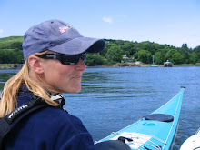
Here's David taking that all important setting off photo.


Houses in Preston backing onto the canal.


Just about to leave Preston, conditions nice and calm.


Now out in the countryside and unfortunately water drops on the camera.


More water on the camera and a lovely avenue of trees.


The weather was kind to me, virtually no rain and I was often paddling on mirror smooth water.


Just occasionally I was exposed to the wind, more often than not in my favour.


In Garstang, Galgate, Lancaster and Carnforth there were marinas full of pleasure boats. I didn't encounter many moving boats en-route but those I did come across were a little surprised to be overtaken by a kayak.


 Here's the route in full. On a road atlas it looks a long way. Surprisingly it didn't seem that far. I broke the journey down into 10 km sections as measured by my GPS as I went along. Every 10km I allowed myself a short stop for food and drink and at the halfway point I got out of my boat for a leg stretch. Oddly, the first 10km was the hardest, after that the distances flew past. The whole journey took me a little over 9 hours with an average speed of 7.3km/h.


Monday 7 April 2014

A blustery Paddle from Cemaes

The weather forecast promised that Saturday would be the best of the weekend, so five hardy members of NWSK set off from Cemaes bay to blow the cobwebs away. It was another chance for me to get to grips with my new camera. I've mounted it on my front deck so all pictures are going to include a triangle of boat complete with spare paddle. I'm also trying out a new paddle holder from Reed. Normally I carry my splits on the back deck of my boat but a few problems recently have led me to experiment with them on the front deck. At least I can see if they are coming loose.
Here we are waiting for Jimski to get launched.


 As we head out of Cemaes bay the camera captures this insignificant little splash. Not desperately exciting but I just like the picture. I'm hoping for better things in the future but it's fun to find out what the camera can do.


 Rounding the corner out of Cemaes bay the island of Middle Mouse came into view. As a group we had opted for a more challenging trip and the sight of an island sitting in the middle of a tide race was more than we could resist. We made the short hop across to middle mouse, then misjudged the speed of the flow and ended up missing the upstream end of the island and had to about-turn and make for the eddy downstream. Unfortunately as usual the picture doesn't do justice to the water conditions.


Another picture with water on the lens but I couldn't resist this narrow gully.


In all we paddled about 20km from Cemaes Bay, to Middle Mouse and on to Bull Bay for lunch before returning by a more direct route to Cemaes. As we approached Bull Bay were became aware of a mayday call from a small boat at a location very close to ours. Visibility was pretty poor and we were unable to see the boat in question. Fortunately another group of kayakers were able to relay VHF messages between the boat and coastguard and provide information regarding the boats location. This was another great example of the value of carrying a VHF and informing the coastguard of intended whereabouts. As we left Bull Bay we saw the conclusion of a successful lifeboat rescue as the small boat and crew were brought ashore.
Our trip ended with a blast into wind of about force 6 as we turned the corner into Cemaes bay. It felt good to have managed an exciting trip in blustery conditions.


Sunday 6 April 2014

Great Orme at Night


 Having suffered the frustration of traffic queues on the A55 knowing that Jimski and the others were already on the beach, it was a relief to unload, kit up and get afloat. This is the launch, into calm sea on a lovely evening with the prospect of a good sunset. It was also the first outing for my new GoPro camera.


As the camera lens gathered droplets of water we made easy progress towards the imposing cliffs of the Orme.


Cruising along under the cliffs the sea took on a glassy surface as the sun sank lower and daylight faded.


Darker still and the moon makes an appearance.


We paddled just 9km, starting from the prom in Llandudno, paddling directly out to the cliffs of the Orme to a point just short of the tip of the peninsula. The return journey was much closer inshore with the bright lights of Llandudno reflecting in the water. It is lovely to paddle at night and this trip, though short was a lot of fun and a good way to start the weekend.